Telemetry Extractor
Convert the sensor data recorded by GoPro and many other cameras (GPS, Accelerometer, Gyroscope, camera settings and more) to formats for Google Earth/Maps, Excel, Numbers, Calc, ArcGIS, After Effects, Kinomap, and more mapping and data software. Interact with data graphs and GPS maps of the video, filter out bad data and compute new streams. Merge the data of consecutive videos quickly for data-intensive analysis workflows.


$449$349
Currency conversion may applyPay once
Use forever
1 Year Updates & Support
Download Telemetry Extractor

Purchase for Windows
Win 10, 11, 12...

Purchase for macOS
Apple Silicon & Intel

Purchase for Linux
DEB & RPM packages

Tutorials
Learn to use the software
Record good GPS data with GoPro cameras

All 3 major action camera brands support some level of GPS data in 2024

The GoPro HERO13 Black brought back GPS data and retained its quality

User Reviews
Professionals and hobbyists alike are joining the Telemetry club
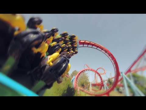
Examples
Users of the software putting it to the test and other videos for inspiration
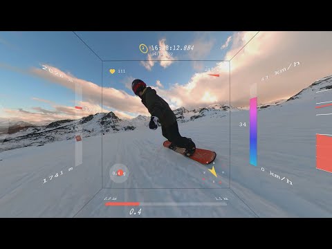
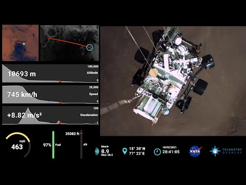
We can animate any shape in Adobe After Effects thanks to MGJSON files
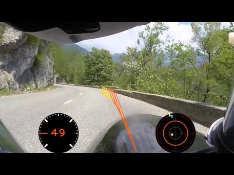
Extracting the data allows us to process it in custom ways to create new values and visualizations
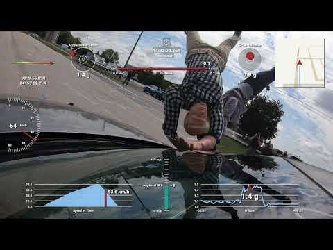
Camera data like GPS, accelerometer and gyroscope can be used in accident reconstruction and investigation
